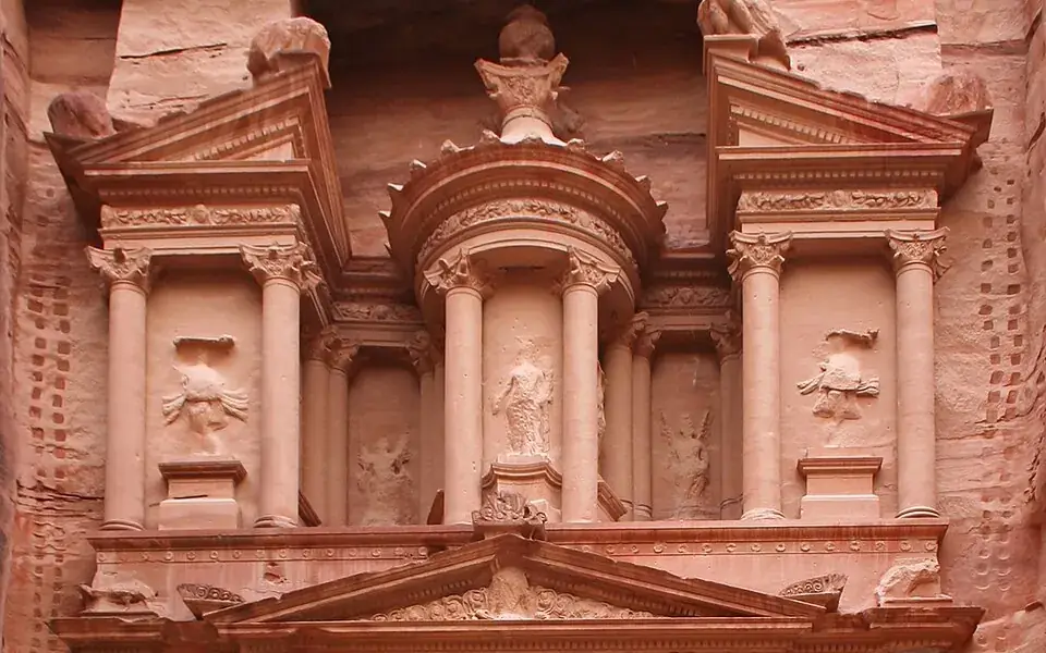
Petra's famous façades were carved from rock, but the city also had channels, water-storage facilities, and other buildings. It was more than a collection of beautiful entrances.
Nabataean trade and water management supported the city's growth. The familiar name Treasury comes from later legend, rather than a confirmed original use.
Emergence of Petra
The Nabataeans were one among several nomadic Bedouin tribes that roamed the Arabian Desert and moved with their herds to wherever they could find pasture and water. Although the Nabataeans were initially embedded in Aramaic culture, theories about them having Aramean roots are rejected by many modern scholars. Instead, archaeological, religious and linguistic evidence confirm that they are a northern Arabian tribe. Current evidence suggests that the Nabataean name for Petra was Raqēmō, variously spelled in inscriptions as rqmw or rqm.
An old theory held that Petra might be identified with a place called sela in the Hebrew Bible. Encyclopædia Britannica (1911) states that the Semitic name of the city, if not Sela, would remain unknown. It nevertheless cautioned that sela simply means "rock" in Hebrew, and thence might not be identified with a city where it occurs in the biblical text in the book of Obadiah. It is possible that the city was part of the nation of Edom.
The passage in Diodorus Siculus (xix. 94–97) described the Nabataeans at the time as a nomadic group of people who believed that those who owned possessions could be easily compelled by those who held power, this would drastically change as the centuries went on. This text further describes the expeditions which Antigonus sent against the Nabataeans in 312 BC, was understood by some researchers to throw some light upon the history of Petra, but the "petra" (Greek for rock) referred to as a natural fortress and place of refuge cannot be a proper name, and the description implies that there was no town in existence there at the time.
Layout
Petra is adjacent to the mountain of Jabal Al-Madbah, in a basin surrounded by mountains forming the eastern flank of the Arabah valley running from the Dead Sea to the Gulf of Aqaba.
Excavations have demonstrated that it was the ability of the Nabataeans to control the water supply that led to the rise of the desert city, creating an artificial oasis. The area is visited by flash floods, but archaeological evidence shows that the Nabataeans controlled these floods by the use of dams, cisterns, and water conduits. These innovations stored water for prolonged periods of drought and enabled the city to prosper from its sale.
In ancient times, Petra might have been approached from the south on a track leading across the plain of Petra, around Jabal Haroun ("Aaron's Mountain"), the location of the Tomb of Aaron, said to be the burial place of Aaron, brother of Moses. Another approach was possibly from the high plateau to the north. Today, most modern visitors approach the site from the east. The impressive eastern entrance leads steeply down through a dark, narrow gorge, in places only 3–4 m (10–13 ft) wide, called the Siq ("shaft"), a natural geological feature formed from a deep split in the sandstone rocks and serving as a waterway flowing into Wadi Musa.
Geostrategic importance
Pliny the Elder and other writers identify Petra as the capital of the Nabataean Kingdom and the centre of their caravan trade. Enclosed by towering rocks and watered by a perennial stream, Petra not only possessed the advantages of a fortress, but controlled the main commercial routes which passed through it to Gaza in the west, to Bosra and Damascus in the north, to Aqaba and Leuce Come on the Red Sea, and across the desert to the Persian Gulf.